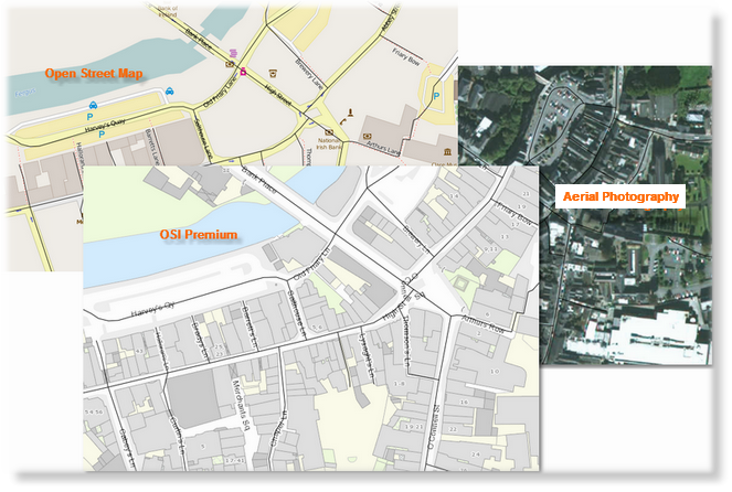
The map viewer has three basemap options to choose from. The default is OSI Premium. OSI premium basemap: This is the default basemap and provides detailed mapping of streets, locations, waterways and other natural and man made features. Open Street basemap: OpenStreetMap is built by a community of mappers that contribute and maintain data about roads, trails, cafés, railway stations, and much more, all over the world. OSI Aerial Photography: This provides up to date aerial photography.
|
Zooming in and out There are 2 ways to change the scale of the map viewer (zoom in and out): 1.Rolling the wheel on your mouse forward or back 2.Clicking on the + or - buttons Drawing Tools Choose from a marker or polyline to mark the excavation area or trench line. |
The coordinates systems available are GPS (Global Positioning System), ITM (Irish Transverse Mercator) and ING (Irish National Grid) . The default system used is GPS and the latitude and longitude coordinates are shown on the bottom right corner of the map.
Switching Coordinate Systems To switch between coordinate systems, scroll to the bottom of the map and click on the GPS, ING or ITM button.
Input Coordinates To input coordinates, click on the pencil icon on the bottom right which will open up the fields for editing. Click into each field and change the coordinates to those desired which will centre the map accordingly. When finished, click on the pencil icon. 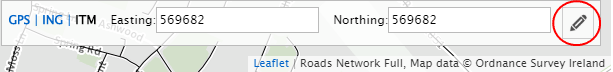 |
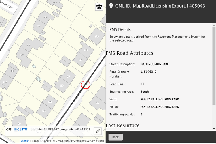
The road network is overlaid on the base map. To view the road attribute details, zoom in on the map and click on the roadway. This will retrieve the information from the Pavement Management System.
Last Resurfaced Information Where available, the date, name and description for when the roadway was last resurfaced will be shown. Next Resurfacing Information Where available, the date, name and description for when the roadway is scheduled to next be resurfaced will be shown. |